The 12 Best Hikes in Glacier National Park for 2026

Glacier National Park, often called the 'Crown of the Continent,' presents a landscape carved by ancient ice, leaving behind a breathtaking collection of alpine lakes, wildflower-strewn meadows, and dramatic, jagged peaks. With over 700 miles of trails, choosing the right adventure can feel daunting. This guide simplifies your planning by curating the 12 most rewarding hikes in Glacier National Park, meticulously selected to showcase the park's diverse beauty. Our list covers everything from iconic, accessible walks to challenging, high-altitude summits, ensuring there is a perfect trail for every fitness level and ambition.
We go beyond just naming trails. For each hike, you'll find a comprehensive breakdown designed for practical use. This includes detailed statistics like distance, elevation gain, and difficulty rating, alongside essential logistical information covering trailheads, shuttle systems, required permits, and crucial parking advice. We also prioritize your well-being with specific safety tips for navigating Glacier's wild terrain, from bear and avalanche precautions to understanding its notoriously unpredictable weather. Whether you are planning a serene half-day stroll to an alpine lake or an epic multi-day trek across a mountain pass, this guide provides the actionable insights needed to craft a memorable journey. For athletes and adventurers who track their accomplishments, each of these routes offers a unique story. We'll highlight how tracking your hike with an app like Strava can transform your achievement into a stunning personalized trail map poster from RoutePrinter, a perfect memento for any accomplished runner, cyclist, or hiker.
1. Gunsight Pass Trail
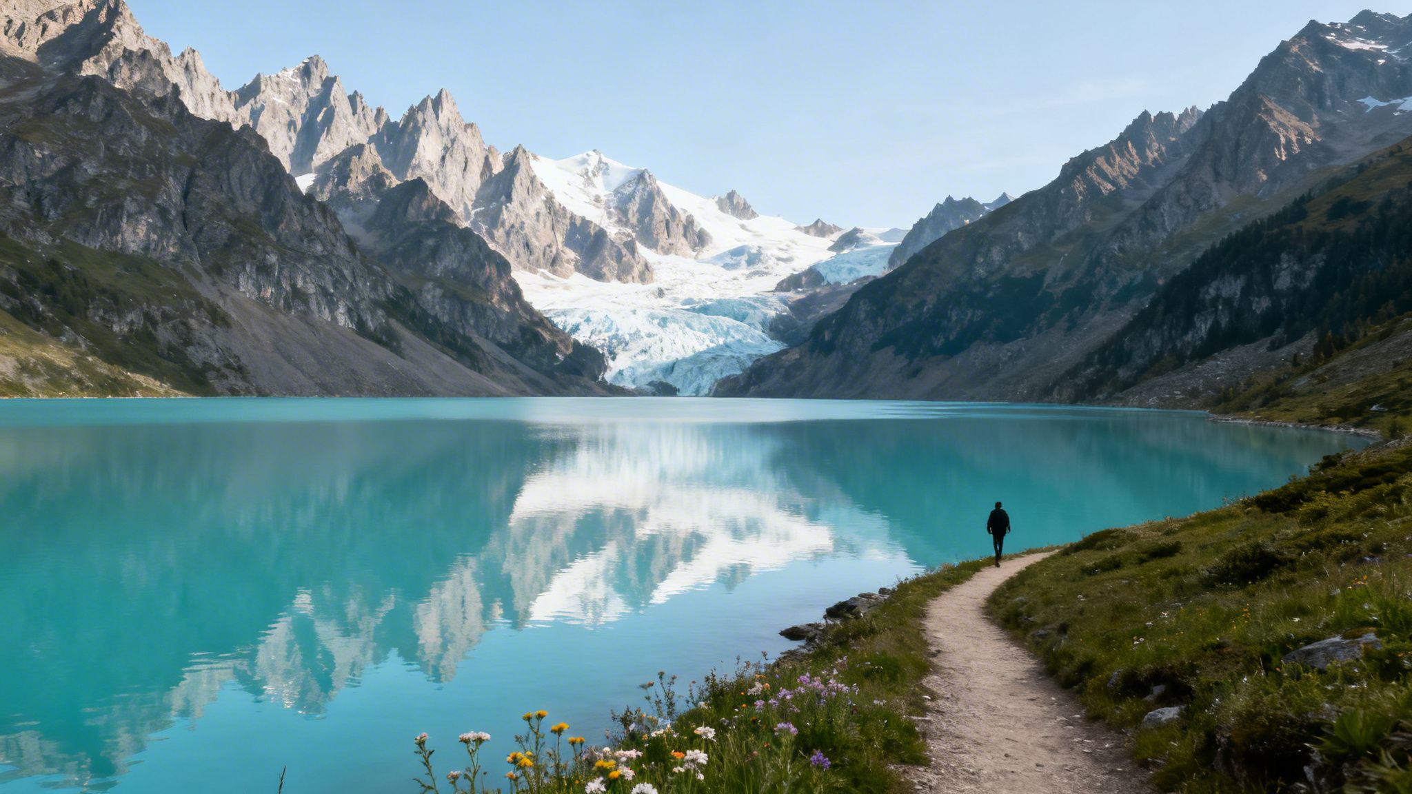
The Gunsight Pass Trail is one of the most rewarding and challenging day hikes in Glacier National Park, offering an unforgettable alpine journey. This strenuous trail showcases the park's dramatic beauty, from cascading waterfalls to expansive glacial valleys, making it a bucket-list item for experienced hikers.
The most common out-and-back route begins at the Jackson Glacier Overlook and travels to the picturesque Gunsight Lake. This segment offers a condensed version of the full thru-hike, providing access to some of the trail's best features without requiring a multi-day commitment or complex shuttle logistics.
Trail Stats & Logistics
- Distance: 10.7 miles (out-and-back to Gunsight Lake)
- Elevation Gain: 1,900 feet
- Difficulty: Strenuous
- Estimated Time: 5-7 hours
- Trailhead: Jackson Glacier Overlook on the Going-to-the-Sun Road
Why It's a Top Hike
Gunsight Pass delivers a quintessential Glacier experience, combining turquoise alpine lakes, glacier views, and the potential for wildlife sightings. The significant elevation gain makes the final destination feel truly earned, providing a powerful sense of accomplishment.
Because of its iconic status and visually striking route, many hikers commemorate this achievement. Tracking your hike on an app like Strava allows you to create a custom poster of your route, turning a memorable day into a unique piece of art. This is an excellent way to celebrate conquering one of the best hikes in Glacier National Park.
Pro Tip: Start your hike before 8 a.m. to secure parking at the small Jackson Glacier Overlook lot and enjoy the trail with fewer people. The early morning light also provides the best conditions for photography.
2. Heavens Peak Trail
The Heavens Peak Trail is an incredibly demanding but supremely rewarding off-trail scramble, a true test of endurance for seasoned peak baggers. This unofficial route ascends one of Glacier's most iconic and dramatic peaks, offering breathtaking, 360-degree summit views that are earned through grit and expert navigation.
Reaching the summit is a significant accomplishment, involving steep inclines, exposed ridges, and challenging route-finding. This is not a maintained trail, but a climb followed by experienced hikers seeking one of the most memorable ascents among the many hikes in Glacier National Park. The feeling of standing atop Heavens Peak is unparalleled.
Trail Stats & Logistics
- Distance: 8.8 miles (round-trip)
- Elevation Gain: 4,000 feet
- Difficulty: Extremely Strenuous (Off-trail scramble)
- Estimated Time: 6-8 hours
- Trailhead: The Loop on the Going-to-the-Sun Road
Why It's a Top Hike
Heavens Peak provides an unmatched sense of adventure and a powerful feeling of achievement. The staggering 4,000-foot elevation gain over a short distance and the exposed summit ridge make it a bucket-list climb for those with the necessary skills and fitness.
Many who conquer this peak want to commemorate the climb. Tracking your journey on an app like Strava captures the impressive elevation profile and unique route. This data can be used to create a custom poster, transforming your hard-won victory into a stunning piece of art that celebrates one of Glacier's most formidable challenges.
Pro Tip: Start this climb before dawn. An early start ensures you have ample daylight, better weather conditions at the summit, and more time to navigate the challenging, unmarked terrain safely. Bring plenty of water.
3. Grinnell Glacier Trail
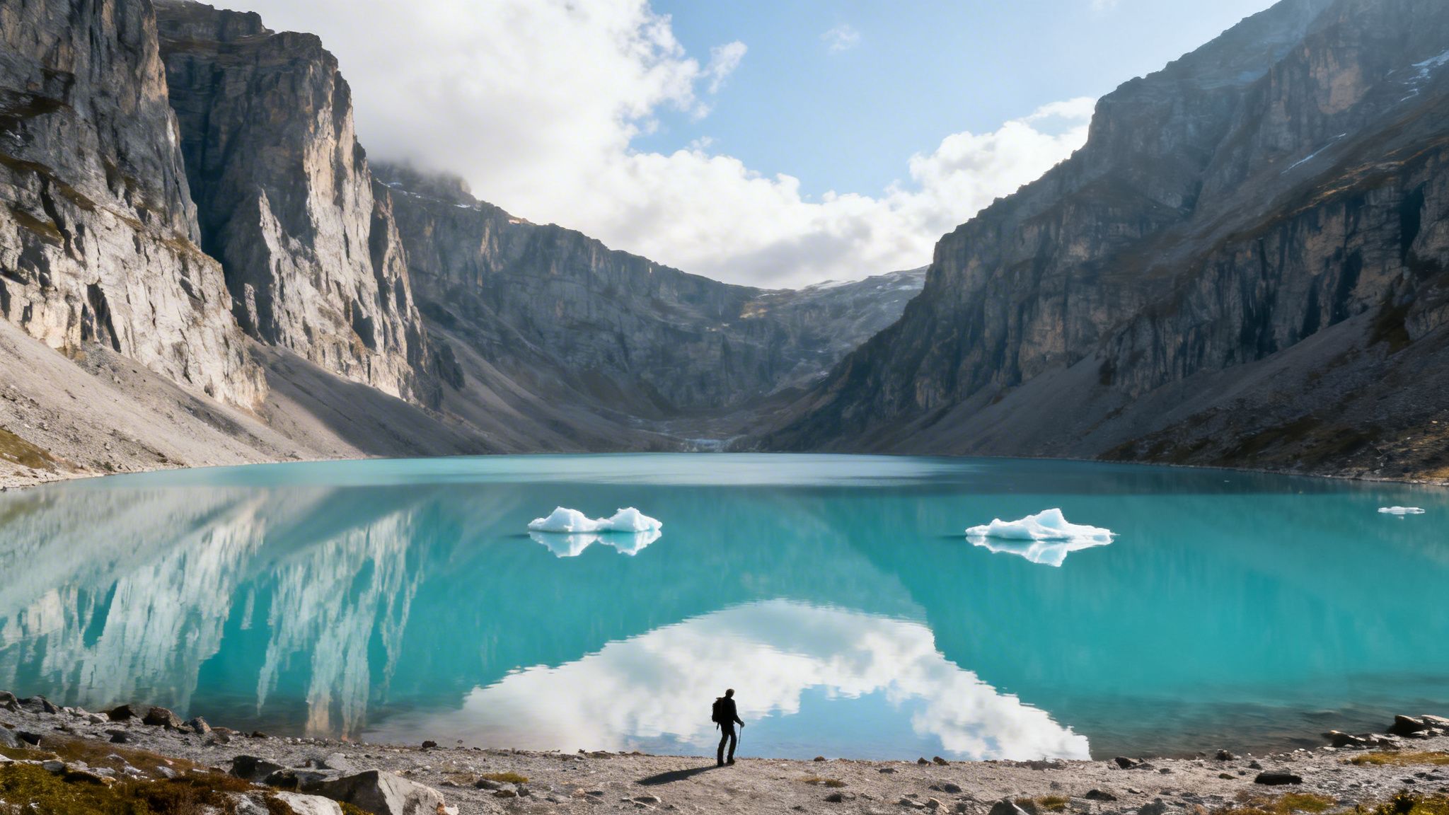
The Grinnell Glacier Trail is arguably one of the most iconic and visually stunning hikes in Glacier National Park, leading adventurers to the very edge of an active glacier. This popular trek offers an unparalleled journey through a landscape carved by ice, featuring multiple turquoise lakes, dramatic cliffs, and abundant wildlife.
The hike can begin directly from the Grinnell Glacier Trailhead or be shortened by taking concessionaire boats across Swiftcurrent Lake and Lake Josephine, trimming off several miles. Regardless of the start, the trail culminates in a breathtaking panorama of Upper Grinnell Lake and the Salamander and Grinnell Glaciers.
Trail Stats & Logistics
- Distance: 10.6 miles (out-and-back from trailhead)
- Elevation Gain: 2,181 feet
- Difficulty: Strenuous
- Estimated Time: 5-6 hours
- Trailhead: Grinnell Glacier Trailhead in the Many Glacier area
Why It's a Top Hike
The Grinnell Glacier Trail delivers a high-impact experience with a constant stream of incredible scenery, making it one of the most rewarding hikes in Glacier National Park. The trail’s steady ascent reveals progressively grander views, ensuring every step is captivating. For those new to challenging hikes, exploring easy hiking trails first can be a great way to prepare.
This hike is a prime candidate for creating a commemorative poster. Tracking your route on Strava captures the journey past three distinct turquoise lakes, providing a visually segmented map. This digital record can be transformed into a custom print, serving as a powerful reminder of the day you hiked to an ancient glacier.
Pro Tip: Parking at the Many Glacier trailhead fills up extremely early, often before 7 a.m. Arrive at sunrise to secure a spot and enjoy cooler temperatures for the initial, exposed section of the trail. Taking the first boat tour is another excellent strategy to get ahead of the crowds.
4. Iceberg Lake Trail
The Iceberg Lake Trail is one of the most iconic and accessible full-day hikes in Glacier National Park, leading to a stunning alpine lake where icebergs often float well into the summer. This moderately challenging hike offers a spectacular reward-to-effort ratio, featuring wildflower-filled meadows and dramatic views of a 3,000-foot rock cirque.
Its relatively gentle grade and breathtaking destination make it a park favorite. The trail begins in the Many Glacier area, ascending gradually through open terrain before reaching the pristine, turquoise waters of Iceberg Lake, making it a perfect choice for a memorable day hike.
Trail Stats & Logistics
- Distance: 9.7 miles (out-and-back)
- Elevation Gain: 1,275 feet
- Difficulty: Moderate
- Estimated Time: 4-6 hours
- Trailhead: Behind the Swiftcurrent Motor Inn in the Many Glacier Valley
Why It's a Top Hike
Iceberg Lake provides one of the most unique hiking destinations in the park without requiring a grueling climb, making it one of the most popular hikes in Glacier National Park. The trail's classic out-and-back route is perfect for capturing a clean and memorable GPS track.
Completing this hike is an achievement worth celebrating. By tracking your journey with an app like Strava, you can turn your 9.7-mile route into a custom poster. This transforms your accomplishment into a modern piece of art, perfectly commemorating the day you reached the unforgettable, iceberg-dotted lake.
Pro Tip: Arrive at the trailhead before 7 a.m. to secure a parking spot and avoid the largest crowds. While the lake is beautiful all day, the turquoise color often intensifies in the early afternoon, providing the best photo opportunities.
5. Highline Trail (Going-to-the-Sun Road Section)
The Highline Trail is arguably the most famous and iconic of all hikes in Glacier National Park, offering breathtaking, continuous views as it traverses the Garden Wall high above the Going-to-the-Sun Road. This remarkable trail is carved into the side of the Continental Divide, providing an exhilarating experience with minimal strenuous climbing for the majority of the route.
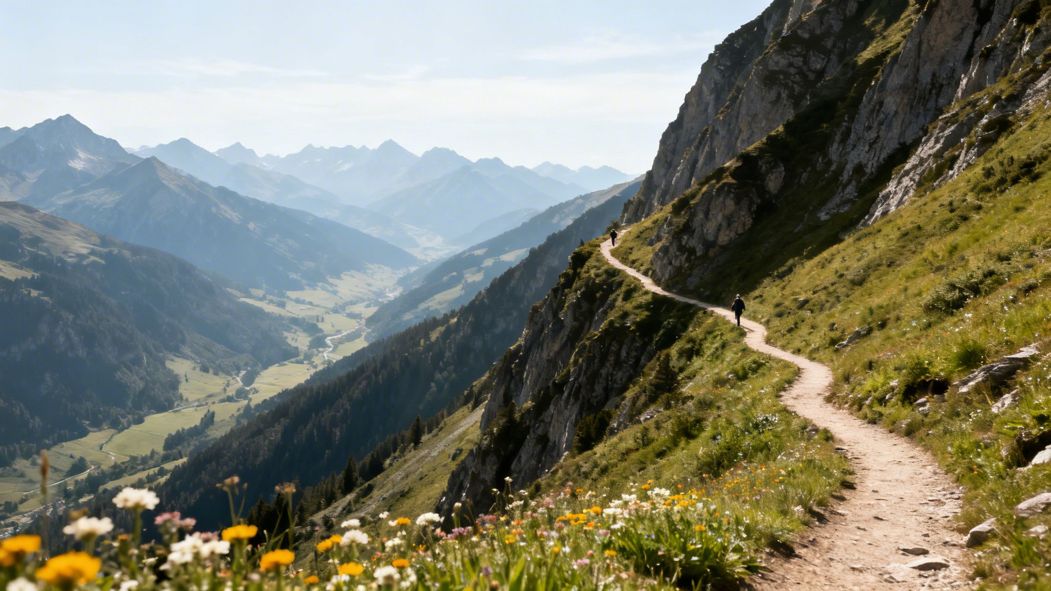
The classic one-way journey from Logan Pass to The Loop provides a full day of alpine splendor, from vibrant wildflower meadows in mid-summer to frequent wildlife sightings like bighorn sheep and mountain goats. It's a must-do for any avid hiker visiting the park.
Trail Stats & Logistics
- Distance: 11.8 miles (one-way to The Loop)
- Elevation Gain: 800 feet (with a 2,500-foot descent)
- Difficulty: Moderate to Strenuous (due to length)
- Estimated Time: 6-8 hours
- Trailhead: Logan Pass Visitor Center (ends at The Loop shuttle stop)
Why It's a Top Hike
The Highline Trail offers some of the most spectacular, non-stop scenery in North America without requiring a grueling ascent, making it uniquely rewarding. Its sustained elevation profile and dramatic path along the Garden Wall make it a prime candidate for a commemorative route poster.
Tracking the full 11.8-mile shuttle hike on Strava captures its impressive, extended profile against the Continental Divide, creating a visually stunning piece of art. This allows you to celebrate completing one of the most beautiful hikes in Glacier National Park and bring a piece of its grandeur home. For those interested in shorter, equally scenic routes, you can explore options like the Cascade Falls Trail in other parks for inspiration.
Pro Tip: Start at Logan Pass and hike to The Loop. This route is primarily downhill, saving your knees. Take the free park shuttle from The Loop back to Logan Pass, but be sure to check the shuttle schedule beforehand as the last one runs in the late afternoon.
6. Siyeh Pass Trail
The Siyeh Pass Trail offers one of the most diverse and stunning alpine journeys in Glacier National Park. This demanding hike takes adventurers through wildflower-filled meadows, past turquoise lakes, and over a high mountain pass with breathtaking panoramic views. It’s an ambitious route that rewards seasoned hikers with a true sense of backcountry immersion.
Most hikers tackle this as a loop, starting at Siyeh Bend and ending at Sunrift Gorge, which requires shuttle coordination. The route travels through Preston Park, a hanging valley, before climbing steeply to the barren, wind-swept pass, showcasing the park's dramatic ecological transitions.
Trail Stats & Logistics
- Distance: 10.1 miles (point-to-point loop)
- Elevation Gain: 2,230 feet
- Difficulty: Strenuous
- Estimated Time: 6-8 hours
- Trailhead: Siyeh Bend on the Going-to-the-Sun Road (ends at Sunrift Gorge)
Why It's a Top Hike
Siyeh Pass delivers an epic cross-section of Glacier's terrain, making it a favorite for those seeking a serious challenge. The hike features three distinct environments: dense forest, vibrant alpine meadows, and a rocky, high-altitude pass. This variety makes it one of the most memorable hikes in Glacier National Park.
Completing this demanding loop is a major accomplishment. Documenting your trek with a GPS app allows you to create a custom poster of the impressive route and elevation profile. This serves as a powerful memento of a day spent exploring the park's high country.
Pro Tip: Park at Sunrift Gorge and take the free park shuttle up to the Siyeh Bend trailhead. This allows you to hike back to your car, eliminating any stress about catching a shuttle after a long and tiring day on the trail.
7. Piegan Pass Trail
The Piegan Pass Trail offers an incredible high-alpine experience without the extreme mileage or elevation gain of other pass hikes, making it one of the more accessible yet rewarding hikes in Glacier National Park. This stunning route takes you through vibrant wildflower meadows and across a dramatic mountain pass, providing panoramic views of the surrounding peaks and hanging valleys.
This trail is a favorite for its direct ascent to Piegan Pass (7,620 feet), which serves as a spectacular destination and turnaround point. The journey provides breathtaking scenery every step of the way, culminating in an awe-inspiring vista from the top.
Trail Stats & Logistics
- Distance: 9.0 miles (out-and-back)
- Elevation Gain: 1,750 feet
- Difficulty: Moderate to Strenuous
- Estimated Time: 5-6 hours
- Trailhead: Piegan Pass Trailhead (Siyeh Bend) on the Going-to-the-Sun Road
Why It's a Top Hike
Piegan Pass is the perfect choice for hikers wanting a taste of Glacier's high country with a manageable challenge. The view from the pass is truly world-class, encompassing the Garden Wall, Piegan Glacier, and Mount Siyeh. The distinctive geography makes it a visually compelling route.
Commemorating this achievement is a great way to remember the day. Tracking your hike on Strava allows you to capture key data points like your peak elevation of 7,620 feet at the pass. This information can be integrated into a custom route poster, creating a unique piece of art that highlights the impressive alpine crossing you completed on one of the best hikes in Glacier National Park.
Pro Tip: Start early to ensure you cross the pass in clear, calm conditions, as weather can change quickly at high elevations. The pass itself creates a natural focal point, making it an excellent subject for photography and poster design.
8. Mount Jackson Loop Trail
The Mount Jackson Loop Trail is an ambitious and highly rewarding endeavor for peak baggers and experienced hikers seeking a true alpine challenge in Glacier National Park. This demanding route ascends to the summit of Mount Jackson, one of the park's iconic 10,000-foot peaks, delivering unparalleled panoramic views that stretch across the continental divide.
This trail is less of a casual day hike and more of a mountaineering objective. The route involves off-trail navigation, scrambling, and exposure, requiring solid route-finding skills. It is a true test of endurance and mountain sense, making the summit a significant achievement for anyone who completes it.
Trail Stats & Logistics
- Distance: 11.4 miles (loop)
- Elevation Gain: 3,200 feet
- Difficulty: Strenuous/Class 3 Scramble
- Estimated Time: 6-8 hours
- Trailhead: Jackson Glacier Overlook on the Going-to-the-Sun Road
Why It's a Top Hike
Mount Jackson offers a genuine sense of accomplishment, combining a strenuous ascent with breathtaking, 360-degree views of Harrison Glacier, Gunsight Lake, and the vast park landscape. Reaching the 10,052-foot summit is a milestone worthy of commemoration for any serious hiker or mountaineer.
Celebrating this achievement is part of the experience. Tracking your journey on Strava allows you to document the incredible elevation gain and create a custom poster of your route. Highlighting the 10,052-foot peak on a print transforms a grueling day of effort into a piece of motivational art, celebrating a premier accomplishment among hikes in Glacier National Park.
Pro Tip: This is a serious alpine route. Always check the latest weather forecast, bring layers for exposed sections, and carry a helmet for the scramble. Start very early to allow ample time for the ascent and descent before afternoon storms develop.
9. Scenic Point Trail
The Scenic Point Trail is a short but incredibly steep hike that rewards persistent climbers with some of the most expansive and unique panoramas in the Two Medicine area. While its distance is modest, the trail demands respect for its relentless vertical climb, making it a fantastic challenge for hikers seeking maximum reward for their effort.
This intense out-and-back route zig-zags up the side of Mount Henry, quickly leaving the forest behind for an exposed, windswept ridgeline. The destination is a rocky outcrop offering breathtaking 360-degree views of the Two Medicine Valley, the Great Plains to the east, and the distant Mission Mountains.
Trail Stats & Logistics
- Distance: 3.2 miles (out-and-back)
- Elevation Gain: 2,150 feet
- Difficulty: Strenuous
- Estimated Time: 2-3 hours
- Trailhead: Located at the end of the Scenic Point access road, just east of the Two Medicine entrance.
Why It's a Top Hike
Scenic Point is defined by its remarkable efficiency, packing over 2,000 feet of elevation gain into just 1.6 miles one-way. This incredible elevation-to-distance ratio makes it a standout achievement among the many incredible hikes in Glacier National Park and a favorite for fitness-focused hikers.
Capturing this intense climb is a great way to commemorate the effort. Tracking your hike on Strava will precisely record the steep grade, allowing you to create a custom poster that visually showcases the impressive vertical data. It's a perfect way to celebrate a truly powerful and challenging hike.
Pro Tip: Start this hike as early as possible in the morning. The trail is highly exposed to the sun and wind, and afternoon temperatures can make the steep ascent significantly more difficult.
10. Avalanche Lake Trail
The Avalanche Lake Trail is a classic Glacier National Park hike, beloved for its accessibility and stunning payoff. This relatively gentle trek winds through a lush, old-growth cedar forest before opening up to a breathtaking alpine lake framed by towering, waterfall-streaked cliffs. Its beauty makes it one of the most popular hikes in the park.
Beginning at the Trail of the Cedars, the path follows the vibrant Avalanche Creek gorge before ascending gradually to the lake. The forest immersion combined with the dramatic reveal of the lake cirque makes this a powerful and memorable journey, suitable for families and hikers of all skill levels.
Trail Stats & Logistics
- Distance: 4.6 miles (out-and-back)
- Elevation Gain: 757 feet
- Difficulty: Easy to Moderate
- Estimated Time: 2-3 hours
- Trailhead: Trail of the Cedars, near Avalanche Campground on the Going-to-the-Sun Road
Why It's a Top Hike
Avalanche Lake offers an immense scenic reward for a modest effort, making it a perfect introduction to the park's grandeur. The contrast between the shaded, mossy forest and the bright, open basin of the lake creates a distinct visual narrative perfect for commemorating your adventure.
Tracking your hike from the trailhead to the lake with an app like Strava captures the full experience. The resulting route map, showing your journey through the forest to the iconic lake, can be transformed into a custom poster. This serves as a beautiful memento of completing one of the most picturesque hikes in Glacier National Park.
Pro Tip: This is one of the busiest trails in Glacier. Arrive at the trailhead before 7:30 a.m. to find parking and enjoy the serenity of the lake before the crowds arrive. The calm morning water also provides the best reflections of the surrounding peaks.
11. Mount Cleveland Trail
The Mount Cleveland Trail is an unofficial, extremely challenging route to Glacier's highest peak, representing the ultimate test of endurance and mountaineering skill in the park. This is not a maintained trail but a demanding scramble reserved for the most experienced and prepared alpinists. Reaching the 10,466-foot summit is a monumental achievement, offering unparalleled 360-degree views of the entire park and beyond.
The ascent involves navigating steep scree fields, complex route-finding, and significant exposure, making it one of the most ambitious single-day hikes in Glacier National Park. This elite climb is a true test of physical and mental fortitude.
Trail Stats & Logistics
- Distance: ~19.2 miles (round-trip)
- Elevation Gain: ~6,400 feet
- Difficulty: Expert/Extreme
- Estimated Time: 12-16 hours
- Trailhead: Waterton Valley Trailhead at Goat Haunt Ranger Station (requires a boat shuttle)
Why It's a Top Hike
Mount Cleveland is the pinnacle of peak bagging in Glacier. The sheer difficulty and remoteness make the summit a badge of honor, popular with hardcore alpinists and ultrarunners. Successfully completing this route places you in a very small and distinguished group of hikers.
This is a poster-worthy accomplishment that deserves to be commemorated. Tracking the brutal 19.2-mile route on Strava allows you to create a detailed map of your ascent, highlighting the staggering 10,466-foot summit elevation. It's the perfect way to memorialize a truly exceptional achievement.
Pro Tip: This is an unmarked route. Do not attempt this climb without extensive off-trail navigation experience, a GPS device with the route pre-loaded, and a thorough understanding of scree and scramble techniques. Start before dawn to allow for a full day.
12. Dawson Pass Trail
The Dawson Pass Trail offers an incredible alpine crossing that captures the essence of Glacier National Park’s high country. This challenging day hike takes you through flower-filled meadows and past pristine lakes before ascending to the breathtaking views at Dawson Pass, making it a favorite for experienced hikers seeking a less-crowded alternative to more famous routes.
The trail begins in the scenic Two Medicine Valley, steadily climbing toward the pass. The route is well-defined and rewards hikers with panoramic vistas of Mount Jackson, Pumpelly Pillar, and the turquoise waters of No Name Lake. It’s a quintessential journey into the heart of Glacier's rugged backcountry, offering solitude and stunning landscapes.
Trail Stats & Logistics
- Distance: 11.6 miles (out-and-back)
- Elevation Gain: 2,930 feet
- Difficulty: Strenuous
- Estimated Time: 6-8 hours
- Trailhead: North Shore Trailhead at Two Medicine Lake
Why It's a Top Hike
Dawson Pass provides a profound sense of accomplishment as you stand atop the 7,713-foot pass, surrounded by some of the park’s most dramatic peaks. This trail is a perfect example of the epic day hikes in Glacier National Park, combining a significant physical challenge with world-class scenery.
The dramatic ascent to the pass and the stunning alpine scenery make this a fantastic hike to commemorate. Tracking your 11.6-mile journey on an app like Strava allows you to create a custom poster of the route, capturing the impressive elevation profile and the distinct shape of the pass crossing. It’s a wonderful way to celebrate conquering such a memorable alpine trail.
Pro Tip: Bring layers, including a windbreaker and hat. The final approach to Dawson Pass is highly exposed and can be extremely windy and cold, even on a warm summer day. Weather conditions can change in an instant at this elevation.
Comparison of 12 Glacier National Park Hikes
| Trail | Difficulty (implementation complexity) | Resource requirements | Expected outcomes (visual / poster potential) | Ideal use cases | Key advantages |
|---|---|---|---|---|---|
| Gunsight Pass Trail | Challenging alpine crossing; steep switchbacks, high exposure | 10.7 mi RT, 1,900 ft gain; 5–7 hrs; season Jun–Sep; layers, good fitness, Strava tracking | Excellent — distinctive out-and-back to alpine lake with glacier viewpoints | Serious hikers seeking memorable mapped route posters | Iconic glacier scenery; clear turnaround; strong visual route |
| Heavens Peak Trail | Very strenuous summit ascent; exposed ridge sections | 8.8 mi RT, 4,000 ft gain; 6–8 hrs; possible snow into July; limited water | Exceptional — dramatic 4,000‑ft elevation profile and summit focal point | Peak baggers wanting a summit-centered achievement poster | 360° panoramic summit views; powerful elevation narrative |
| Grinnell Glacier Trail | Moderate difficulty with sustained sections | 10 mi RT, 1,600 ft gain; 5–6 hrs; season mid‑Jun–mid‑Sep; early start recommended | Outstanding — multi-lake turquoise route with glacier backdrop | Photogenic hikers and social-media-driven poster designs | Multiple scenic viewpoints; highly recognizable imagery |
| Iceberg Lake Trail | Moderate access with alpine payoff; some crowding | 9.7 mi RT, 900 ft gain; 4–5 hrs; mid‑June onward; early start advised | Very High — turquoise lake with floating icebergs creates strong visuals | Hikers seeking accessible alpine-lake poster opportunities | Consistent turquoise water; dramatic cirque backdrop |
| Highline Trail (Going-to-the-Sun) | Moderate length, mostly flat but exposed | 11.8 mi one-way/loop, ~500–600 ft gain; shuttle option; July–Aug for wildflowers | Excellent — long linear traverse produces impressive map visuals | Long-distance hikers and wildflower season posters | Sustained scenic views; iconic continental-divide route |
| Siyeh Pass Trail | Strenuous long alpine crossing | 14 mi RT, 1,950 ft gain; 7–9 hrs; mid‑Jul–Sep; navigation skills recommended | High — extended mileage with multiple lakes yields complex visuals | Ambitious hikers wanting a multi-feature achievement poster | Remote scenery; varied highlights across route |
| Piegan Pass Trail | Moderate–strenuous alpine pass crossing | 9 mi RT, 1,600 ft gain; 5–6 hrs; late Jul–Sep; limited water | Good — named pass and glacier views give clear focal point | Hikers seeking a pass-centered poster without extreme distance | Distinct pass crossing; glacier vistas; less crowded |
| Mount Jackson Loop Trail | Very strenuous summit loop; high altitude | 11.4 mi loop, 3,200 ft gain; 6–8 hrs; Aug–Sep; high fitness required | Very High — named 10,052 ft summit creates prestigious poster | Summit achievers and alpine accomplishment posters | Loop format; high summit prestige; panoramic views |
| Scenic Point Trail | Very steep, short but intense climb | 3.2 mi RT, 2,150 ft gain; 2–3 hrs; early start; no water | High — steep elevation profile offers dramatic visual narrative | Time-limited hikers or fitness-focused route posters | Exceptional elevation-to-distance ratio; quick payoff |
| Avalanche Lake Trail | Moderate, family-friendly with forest approach | 8 mi RT, 730 ft gain; 3–4 hrs; well-marked; early start to avoid crowds | Good — forest-to-lake transition creates unique poster aesthetic | Families and nature-focused poster designs | Old-growth forest, turquoise lake, accessible trail |
| Mount Cleveland Trail | Extremely difficult elite ascent | 19.2 mi RT, 4,280 ft gain; 10–12+ hrs; late Aug–Sep; scrambling skills required | Exceptional — highest peak and long distance produce ultimate achievement poster | Elite alpinists and endurance hikers wanting a flagship poster | Park-highest summit; maximal prestige and endurance metrics |
| Dawson Pass Trail | Strenuous alpine crossing with diverse scenery | 11.6 mi RT, 2,000 ft gain; 6–7 hrs; mid‑Jul–early Sep; layered clothing | Excellent — pass plus lakes and meadows yields complex visuals | Hikers desiring varied alpine-feature posters | Multiple scenic features; strong narrative (pass + lakes) |
Turn Your Trail Miles into Timeless Art
Glacier National Park is not merely a destination; it's a dynamic, living landscape that challenges and inspires in equal measure. From the sweeping, panoramic vistas of the Highline Trail to the dramatic, ice-carved amphitheater of Grinnell Glacier, each path offers a unique narrative of geological time and personal discovery. We've explored twelve of the most iconic hikes in Glacier National Park, covering everything from accessible lakeside strolls like Avalanche Lake to formidable multi-day treks such as the Gunsight Pass Trail. The common thread is clear: these trails leave an indelible mark on all who walk them.
The true value of these experiences lies not just in the photos you take, but in the memories forged with every step. It’s the feeling of accomplishment as you crest Siyeh Pass, the quiet awe of watching the sunrise over Iceberg Lake, and the shared camaraderie with fellow hikers on the trail. This guide was designed to be more than a simple list; it's a practical toolkit to help you plan, prepare, and fully immerse yourself in these adventures safely and confidently.
From Aspiration to Achievement: Your Next Steps
You now have the detailed logistics, safety protocols, and insider tips needed to transform your hiking aspirations into tangible achievements. The journey from reading about a trail to standing at its summit requires careful preparation. Here’s how to put this guide into action:
- Select Your Challenge: Review the trail stats and descriptions. Are you looking for a strenuous full-day push like the Mount Jackson Loop, or a more moderate but equally stunning objective like Piegan Pass? Match your fitness level and available time with the right trail.
- Logistical Planning: Use the provided trailhead and shuttle information to build your itinerary. Check the official NPS website for current trail conditions, road closures (especially for Going-to-the-Sun Road), and any required permits. Preparation is non-negotiable in a wilderness environment like Glacier.
- Safety First, Always: Internalize the wildlife safety advice, particularly for bears and mountain lions. Pack the ten essentials, understand the signs of hypothermia and altitude sickness, and always have a reliable navigation method. Let someone know your plan before you go.
Key Insight: Mastering the details of planning and preparation doesn't diminish the spontaneity of adventure; it enables it. By handling the logistics beforehand, you free yourself to be fully present and engaged with the incredible beauty surrounding you on the trail.
The Lasting Impact of Your Journey
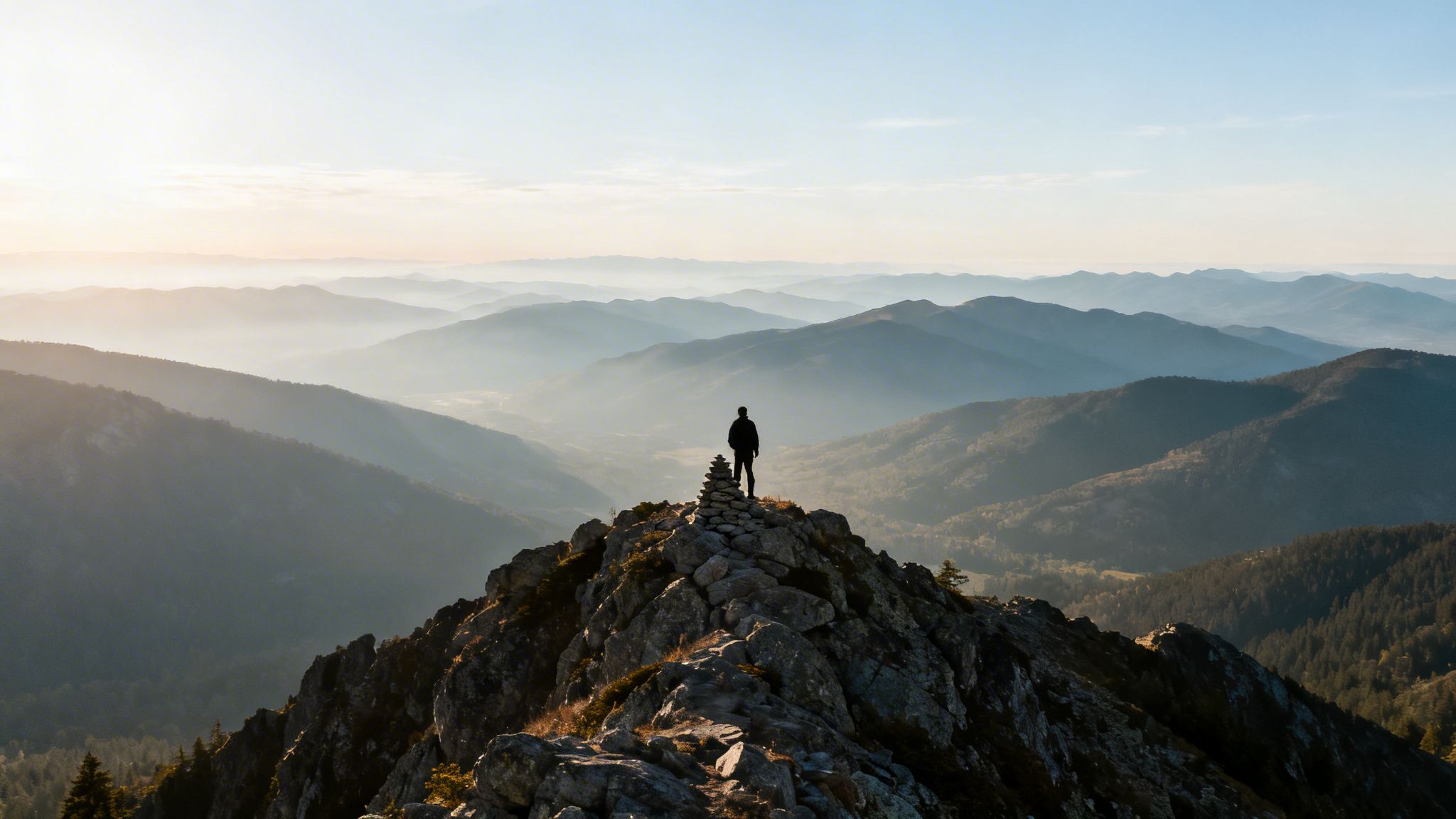
The physical and mental rewards of completing one of these demanding hikes in Glacier National Park extend far beyond the trailhead. Conquering a challenging route builds resilience, confidence, and a profound appreciation for the natural world. Each mile logged is a testament to your dedication and spirit of adventure. These are not just walks; they are personal milestones, stories of perseverance written on the landscape.
As you stand at a viewpoint, looking out over a chain of jagged peaks and pristine valleys, you’re not just seeing a landscape; you’re seeing what you are capable of. This experience becomes part of your story, a source of inspiration long after you’ve returned home. Preserving that feeling, that memory of accomplishment, is the final step in honoring your journey. Let every challenging ascent and breathtaking vista remind you of the strength and determination you carry within.
Ready to celebrate your incredible accomplishment on one of these hikes in Glacier National Park? Transform your GPS track into a beautiful, minimalist art print with RoutePrinter. Visit RoutePrinter to create a custom poster that immortalizes your route, distance, and elevation gain, turning your hard-earned trail data into a timeless piece of decor.